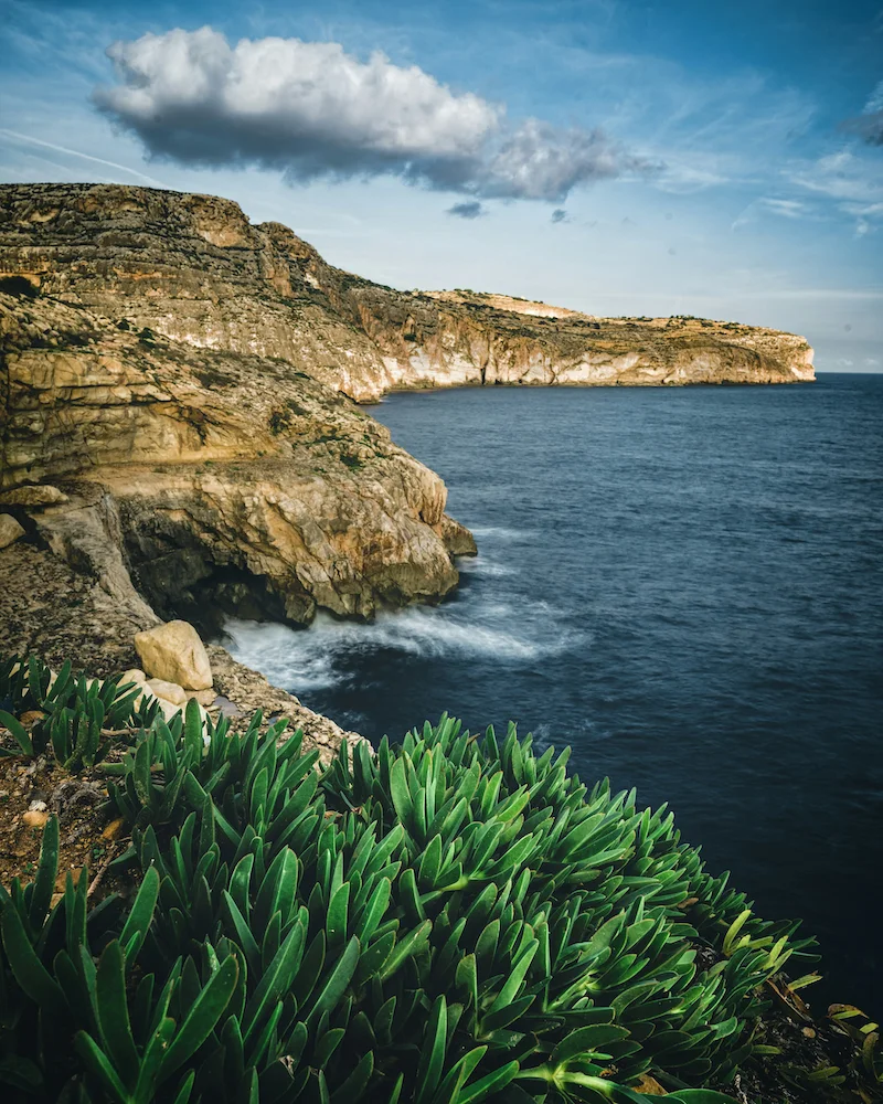
Malta weatherGozo climateMalta microclimatesMediterranean weatherMalta temperature trends
Malta & Gozo Weather Explained: Climate, Microclimates & Trends
A complete guide to the climate and microclimates of Malta and Gozo, including seasonal weather patterns, long-term trends, and how this data powers modern web and mobile applications for travel, agriculture, and real estate.
Contents
Top Malta Solar Company
Virtue SolarisSolar Energy Malta
Malta's #1 Solar Panel Installer
Take advantage of Malta's 300+ sunny days a year. Virtue Solaris designs,
supplies, and installs premium photovoltaic systems for homes and businesses
across the Maltese Islands — with full after-care and government-grant support.
✓
Certified MCS & REWS installers
✓
Free site survey & no-obligation quote
✓
Up to 40% savings on energy bills
✓
Mention WEATHER MALTA for a Bluetti discount coupon!
Want to feature your advert? Email Weather Malta on [email protected] with your specs today!
Understanding Malta's Mediterranean Climate
Malta and its sister islands Gozo and Comino enjoy a classic Mediterranean climate: hot, dry summers and mild, wet winters. Temperatures are moderated by the surrounding sea, which prevents extreme highs and lows. However, the islands' small size (just 316 square kilometres) and varied topography create distinct microclimates that affect everything from agriculture to tourism. For web and mobile developers building weather-dependent services—whether it's a travel app, a farming tool, or a property site—understanding these nuances is critical to delivering accurate, localised data. This article breaks down the climate, its microclimates, and the trends shaping the future of weather in Malta and Gozo.
Climate Overview: Averages and Extremes
Malta's climate is classified as Csa (hot-summer Mediterranean) under the Köppen–Geiger system. The annual average temperature is around 19°C, with July and August averaging 32°C during the day and rarely dropping below 22°C at night. January is the coolest month, with average highs of 15°C and lows of 10°C. Frost is extremely rare, occurring maybe once a decade on the highest ground. Rainfall is concentrated between October and March, with an annual average of about 500–600 mm. Summers are almost completely dry—some months see zero precipitation. Wind is a defining feature: the dominant cool, damp northwesterly (Majjistral), the hot, dry sirocco from the Sahara, and the chilling northeasterly (Grigal) all shape daily conditions. Wind speed data is essential for apps that advise on outdoor activities, diving conditions, or solar energy production.
Microclimates: Where the Weather Varies
Despite the islands' small size, local topography, urbanisation, and coastal exposure create measurable differences in temperature, humidity, and wind. Understanding these microclimates is valuable for mobile app developers who want to offer hyperlocal forecasts or for businesses that depend on precise weather data.
Coastal vs. Inland Areas
The sea moderates temperatures along the coast: summer highs on the waterfront can be 2–3°C cooler than inland areas, while winter nights are a few degrees warmer. Inland areas like the centre of Malta—around Rabat, Mosta, and the Dingli Cliffs—experience greater diurnal swings. A developer building a beach forecast app should pull data from near-shore stations rather than inland met offices to provide accurate sea breeze and water temperature readings.
Elevation Differences
The highest point in Malta is Ta' Dmejrek at 253 metres on the Dingli Cliffs. While modest, this elevation creates a cooler, windier microclimate. Similarly, the hilltop villages of Gozo, such as Nadur and Victoria, are often breezier and slightly cooler than the sheltered valleys like Xlendi or Marsalforn. For apps that include altitude in their weather models, these differences matter: a 3°C gap at the same latitude can affect crop growth estimates or outdoor event planning.
Urban Heat Island Effect
Valletta, Sliema, and St. Julian's are densely built-up, with concrete and asphalt absorbing heat during the day and releasing it at night. This urban heat island effect can raise overnight minimum temperatures by 2–4°C compared to rural Mdina or the Buskett Gardens. For property apps, heat island data helps users assess cooling costs or prefer cooler neighbourhoods. Mobile apps that guide walking tours could also use this data to suggest routes that avoid the hottest spots in summer.
Sheltered Valleys and Depressions
Valleys like Wied il-Għasri in Gozo or Wied Qirda in Malta trap cold air on calm winter nights, forming frost pockets rare elsewhere. In summer, these same valleys can become stiflingly still, with higher humidity than the open coast. Agricultural apps need high-resolution data to advise farmers on frost risk in these areas. Similarly, hikers and mountain bikers benefit from mobile forecasts that account for these local pockets.
Long-Term Weather Trends
Climate change is reshaping Malta's weather. The Malta Meteorological Office recorded that annual mean temperatures have risen by about 1.5°C over the past 50 years, with the largest increases in summer. Heatwaves are becoming more frequent and intense: the 2023 heatwave saw highs of 42°C, breaking records. Rainfall patterns are shifting, with more intense downpours and longer dry spells. These trends have direct implications for web and mobile applications that rely on historical weather data. Developers should use the most recent climate normals (1991–2020) rather than outdated baselines to calibrate weather prediction algorithms. Sea surface temperatures are also rising, affecting diving conditions and marine life. The number of tropical nights (minimum temperature above 20°C) has doubled since the 1970s, impacting Airbnb hosts and hoteliers who need to ensure adequate air conditioning. Smart building management systems can integrate these trends to optimise energy usage.
Season by Season: What to Expect
Winter (December to February)
Winter is the rainy season. Daytime highs average 15–17°C, but the wind makes it feel colder. Rainfall occurs in short, heavy showers, often associated with low-pressure systems from the Atlantic or the Mediterranean. Sunshine hours are still decent—about 5–6 hours per day. For mobile developers, winter is the season to push push notifications for rain alerts or for outdoor event cancellation. Gozo tends to be slightly more exposed to westerly winds, making its north coast (like Marsalforn) rougher in winter.
Spring (March to May)
Spring is the transition season, with gradually warming temperatures and decreasing rainfall. March can still be cool and windy, but by May, highs reach 25°C. The sirocco wind occasionally brings Saharan dust, leading to hazy skies and a fine red dust coating cars and plants. This phenomenon is tracked by air quality apps and pollen alerts. The sea temperature lags behind air temperature; swimmers may need a wetsuit until late May. For travel apps, spring is the golden window for hiking and cycling before the summer heat.
Summer (June to September)
Summer is hot, dry, and dominated by high pressure. July and August are the peak, with temperatures often above 35°C in inland areas and around 30–33°C on the coast. Humidity is moderate but can spike with a southerly wind. The sea breeze provides natural cooling along the coast, but inland areas can become oppressively hot. UV index is extreme (9–10) from late May to August—a critical data point for sun safety apps. Developers integrating weather data into booking platforms should highlight the sea breeze difference to help tourists choose coastal accommodations. Comino is typically the windiest and most exposed, making it feel cooler even in peak summer.
Autumn (October to November)
Autumn is the wettest season, with the highest rainfall in October and November. Storms can be severe, sometimes bringing flash floods in low-lying areas. Temperatures drop from the mid-20s in October to the mid-teens by November. The sea remains warm until late October, making it the best time for extended swimming and diving. For weather apps, autumn requires careful monitoring of thunderstorm risk and surface runoff. Real-time flood alerts are a valuable feature for navigation apps used by drivers and pedestrians in urban areas like Birkirkara or Qormi, where street flooding is common during heavy downpours.
Leveraging Malta Weather Data in Web and Mobile Development
Accurate, localised weather data is a goldmine for developers building applications for tourism, agriculture, energy, and logistics. By integrating open APIs from the Malta Meteorological Office, the European Centre for Medium-Range Weather Forecasts (ECMWF), or commercial providers like OpenWeatherMap, you can offer features such as:
Hyperlocal forecasts using grid-based models that account for microclimates, with updates every hour.
Push notifications for severe weather alerts (e.g., thunderstorm warnings, heatwave advisories, wind gusts over 30 knots).
Historical climate data for trend analysis, useful for property valuation or crop insurance algorithms.
UV index and sea temperature displays for beach and dive oriented mobile apps.
Wind speed and direction overlays for sailing and kiteboarding platforms, especially popular around Mellieħa Bay and Ramla Bay.
Solar irradiance data for smart home energy apps, helping homeowners optimise battery storage and PV panel usage.
For startups or established businesses focusing on the Maltese market, building a weather-aware feature can differentiate your product. Consider also the accessibility of data: the Malta Met Office provides a public API for current conditions, though historical gridded data requires partnership. Open-source libraries like Climacell (now Tomorrow.io) allow for rapid integration. Ensure your app caches data offline, as mobile connectivity can be patchy in rural Gozo or on dinghy trips to Comino.
Practical Tips for Using Weather Information
Always use a weather API that refreshes at least every 30 minutes for real-time accuracy.
For outdoor events, combine synoptic charts with local wind readings from stations like those at Malta International Airport and Gozo's heliport.
If your app serves tourists, include sea temperature and jellyfish risk data (available from the Malta Tourism Authority).
When showing climate trends, cite the source (e.g., Malta Met Office Annual Climate Summary) for credibility.
Consider integrating a 'rain radar' tile overlay using open data from the Malta Met Office or EUMETSAT.
For agricultural apps, use growing degree day calculations based on station data from Buskett or Ghammieri.
The Importance of Accurate Local Weather Data
Malta and Gozo may be small, but their weather is far from simple. Microclimates create meaningful differences that matter to residents and visitors alike. For developers, using high-resolution data not only improves user experience but opens up new possibilities: from smarter travel planning to energy savings. Whether you're building a simple weather widget or a full-featured tourism platform, understanding the climate, microclimates, and trends of the Maltese islands is the first step to delivering value. And if you ever need to cancel a contract for a weather data provider that isn't delivering, Contract Buster is here to help.
Top Malta Solar Company
Virtue SolarisSolar Energy Malta
Malta's #1 Solar Panel Installer
Take advantage of Malta's 300+ sunny days a year. Virtue Solaris designs,
supplies, and installs premium photovoltaic systems for homes and businesses
across the Maltese Islands — with full after-care and government-grant support.
✓
Certified MCS & REWS installers
✓
Free site survey & no-obligation quote
✓
Up to 40% savings on energy bills
✓
Mention WEATHER MALTA for a Bluetti discount coupon!