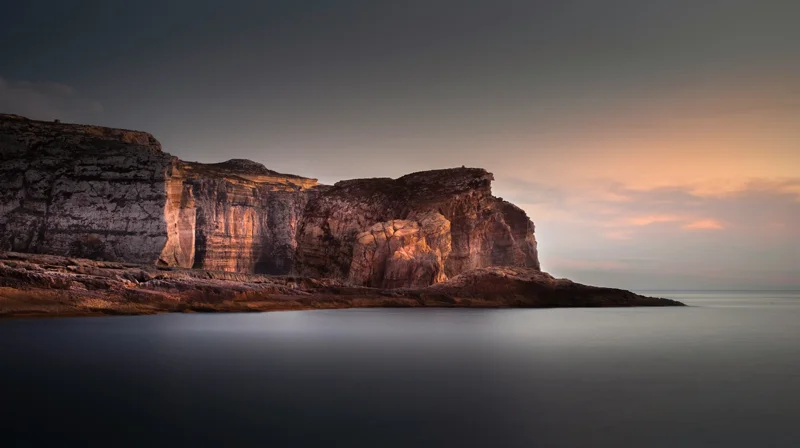
Malta wave forecastGozo sea swellMalta weatherwave height MaltaMediterranean swell
Complete Guide to Sea Wave Forecasts for Malta & Gozo
Everything you need to know about sea wave forecasts in Malta and Gozo: understanding wave height, swell, wind, and using local apps for safe boating, swimming, and diving.
Contents
Top Malta Solar Company
Virtue SolarisSolar Energy Malta
Malta's #1 Solar Panel Installer
Take advantage of Malta's 300+ sunny days a year. Virtue Solaris designs,
supplies, and installs premium photovoltaic systems for homes and businesses
across the Maltese Islands — with full after-care and government-grant support.
✓
Certified MCS & REWS installers
✓
Free site survey & no-obligation quote
✓
Up to 40% savings on energy bills
✓
Mention WEATHER MALTA for a Bluetti discount coupon!
Want to feature your advert? Email Weather Malta on [email protected] with your specs today!
Why Sea Wave Forecasts Matter in Malta & Gozo
The Maltese archipelago, surrounded by the central Mediterranean, experiences some of the most dynamic and rapidly changing sea conditions in the region. For anyone planning a day on the water — whether it's a ferry crossing to Gozo, a diving trip, a sailing charter, or simply a seaside swim — understanding wave forecasts is not just helpful; it can be a matter of safety. This complete guide breaks down how sea waves are measured, what the forecasts really mean, and how to use them effectively in Malta and Gozo. Whether you're a tourist or a local, mastering wave forecasts will elevate your maritime experiences.
The Basics of Wave Forecasting
Wave forecasts describe the state of the sea surface, primarily through three key parameters: significant wave height, peak wave period, and wave direction (also called swell direction). In Malta, marine forecasts are issued by the Malta Meteorological Office and international services like Windy, Windfinder, and Magicseaweed. Understanding these metrics will help you interpret any forecast.
Significant Wave Height (Hs)
Significant wave height (Hs) is the average height of the highest one-third of waves in a given period. It is the standard measure used in all official forecasts. For example, an Hs of 1.5 meters means the typical tallest waves (one in three) are around 1.5 m high. In sheltered Maltese bays, Hs may be much lower than open sea values. A rough guide: less than 0.5 m is calm and ideal for swimming; 0.5–1.5 m is moderate; 1.5–3 m is rough and caution is needed; above 3 m is dangerous for small craft.
Peak Wave Period (Tp)
Peak wave period (Tp) is the time in seconds between successive wave crests. Longer periods (10–15 seconds) indicate powerful, long-period swell that can hit coastlines with significant force, even if wave heights are moderate. Short periods (under 6 seconds) are typically wind-driven chop, which is uncomfortable but less hazardous. In Malta, long-period swell from the west or northwest often arrives during winter storms.
Wave Direction and Swell
Forecasts show the direction from which waves are coming (e.g., northwest at 1.2 m). This is crucial because Malta's coastline is highly indented; a north-westerly swell may batter the north coast but leave the south coast flat. Swell direction is often combined with local wind direction to predict how exposed a particular beach or harbour will be.
Seasonal Wave Patterns Around Malta
The sea around Malta follows a distinct seasonal cycle influenced by prevailing winds and large-scale Mediterranean weather systems.
Summer (June to September)
Summer is the most stable season for sea conditions. The dominant northwesterly winds (Majjistral) are light to moderate, rarely exceeding Force 4. Wave heights typically range from 0.2 to 0.8 m, occasionally rising to 1.2 m during a brief Mistral event. The sea is warm and calm, making it peak season for all water activities. However, the Scirocco wind from the southeast can bring flat seas but also Saharan dust and occasional jellyfish.
Autumn (October to November)
Autumn is transition season. Early October often still has summer-like calm, but November sees increasing storm activity as Atlantic depressions roll in. Wave heights regularly exceed 2 m, and the north and west coasts become dangerous for small boats. The south and east coasts (e.g., Marsaxlokk Bay) remain fairly sheltered. This is a good time for experienced surfers, as some exposed spots like Għadira break into rideable waves.
Winter (December to March)
Winter is the most challenging season. Strong westerly and northwesterly gales generate storm waves often exceeding 4–5 m in the open sea. The Grand Harbour and Marsamxett Harbour are relatively protected, but crossings to Gozo frequently face rough conditions, and ferries are sometimes cancelled. Only enclosed swimming areas like St. Julian's Bay or Xlendi remain calm. Divers in winter must be extremely cautious, particularly around sea caves.
Spring (April to May)
Spring sees a gradual decrease in wave heights as high pressure builds. April can still have occasional rough days (1.5–2 m), but by May, conditions become moderate to calm (0.5–1.2 m). The variable winds of spring (Gregale from northeast, Libeccio from southwest) can produce sudden sea changes, so always check the short-term forecast before heading out.
Best Apps and Websites for Malta Wave Forecasts
Several digital tools provide accurate, real-time wave forecasts for the Maltese Islands. Here are the most reliable, all of which are optimized for mobile (web and app) use.
Windfinder — Excellent for spot-specific forecasts; provides hour-by-hour wave height, period, direction, and wind data. Covers over 30 spots in Malta and Gozo.
Windy.com — Interactive map with layers for wave height, swell period, and wave energy. Uses ECMWF model, widely trusted by sailors.
Magicseaweed — Focused on surf; gives detailed swell analysis including primary and secondary swells. Good for surfers and divers.
Malta Met Office Marine Forecast — Official government source; includes a 48-hour outlook for the Maltese waters. Available on website and social media.
Ventusky – Similar to Windy, with a simple interface and wave overlays. Good for quick checks.
When using these tools, always check the forecast valid time (UTC) and remember that local sea conditions can vary dramatically within a few kilometres. For instance, the sea at Golden Bay may be flat while St. Julian's has a metre of swell.
How to Read a Wave Forecast for a Specific Beach
To know whether a particular beach or cove is safe for swimming or boating, you need to interpret the forecast in relation to the wind and swell direction relative to that location. Here's a step-by-step method:
Check the predicted significant wave height (Hs) for the open area closest to your spot. For example, the north coast of Malta uses the 'Malta North' zone, while southern areas use 'Malta South' or 'Gozo' zone.
Identify the swell direction (e.g., N, NW, W). Compare it to the orientation of the beach. A north-facing beach (e.g., Mellieha Bay) will be fully exposed to north swell but sheltered from south swell.
Look at local wind direction and speed. Strong offshore winds can flatten the sea locally, while onshore winds increase chop and wave height.
Add a safety margin: if the forecast says 1.2 m at 8 seconds, the actual largest waves could be 2.0 m. For swimming, stay below 0.5 m Hs; for small boats, below 1.0 m; for diving, below 1.5 m unless inside a sheltered inlet.
Practical Tips for Different Activities
For Swimmers and Sunbathers
Always check the wave forecast before heading to an unfamiliar beach. Avoid days with Hs above 0.6 m and short periods (under 5 seconds) as these indicate rough chop. Sheltered bays like Xlendi (Gozo), St. Peter's Pool, and Ghar Lapsi are calmer even when open water is rough. Be aware of rip currents in sandy beaches like Ramla Bay; if the waves are breaking heavily, stay between the lifeguard flags.
For Boaters and Yachts
Before renting a boat or taking a charter, always request the latest marine forecast. Many charter companies in Malta provide a free weather briefing. For open crossings (e.g., Comino, Blue Lagoon), avoid Hs above 1.2 m; for coastal trips, 0.8 m is comfortable. The northwest coast of Gozo (Dwejra) can be treacherous in northwesterly swell. Use a VHF radio to get updates; Channel 16 is monitored by the local coast guard.
For Divers and Snorkellers
Wave action affects underwater visibility and safety, especially near caves and drop-offs. Ideal diving conditions occur when Hs is below 0.5 m and swell period is long (over 8 seconds). Many dive sites like the Blue Hole (Gozo) are in exposed areas; check a dedicated 'diving conditions' forecast. If the forecast shows north-westerly swell above 1.0 m, consider sheltered south-coast sites like Wied iz-Zurrieq. Snorkelling is safest in calm conditions with minimal wave action.
Common Misconceptions About Sea Waves in Malta
A few persistent myths can lead to dangerous decisions:
“It’s calm everywhere because the wind is light.” — False: Swell can travel hundreds of kilometres from a distant storm, arriving even in flat calm air. This is common in winter.
“Wave height equals average height.” — No: Significant wave height is the average of the highest one-third; individual waves may reach twice that value.
“The south coast is always calm.” — Incorrect: Southeasterly winds (Gregale) can create sizeable waves on the south coast, especially in winter.
“Forecasts are only for experts.” — Not true: With a bit of practice, anyone can learn to read them. Many local Facebook groups share daily wave reports.
Forecast Services from Contract Buster Perspective
While Contract Buster specialises in helping people exit contracts — from mobile phone plans and gym memberships to boat rental agreements and dive course packages — we also understand that a great trip to Malta relies on preparation. Checking sea wave forecasts is part of that preparation. If you find yourself locked into a booking that you can't use due to poor sea conditions, or if you've signed up for a boat rental that turned out to be unsafe, Contract Buster can help review your contract and find a way out. In the meantime, use this guide to wave forecasts to make informed decisions and avoid the need for cancellations.
Final Checklist Before You Go
To wrap up, here is a quick checklist every time you plan a water activity in Malta or Gozo:
Check the latest marine forecast from the Malta Met Office or a trusted app (Windy, Windfinder).
Identify the swell direction and compare to your beach or route's exposure.
Look at local wind conditions — an offshore wind can make the surface flat even with swell.
Consider the peak wave period: short period = wind chop, long period = powerful swell.
Always tell someone on land where you are going and when you plan to return.
If in doubt, stay onshore. Conditions can change in minutes, especially near the Strait of Sicily.
Malta and Gozo offer some of the finest sea experiences in the Mediterranean. With good preparation and a solid understanding of wave forecasts, you can enjoy them safely and confidently.
Top Malta Solar Company
Virtue SolarisSolar Energy Malta
Malta's #1 Solar Panel Installer
Take advantage of Malta's 300+ sunny days a year. Virtue Solaris designs,
supplies, and installs premium photovoltaic systems for homes and businesses
across the Maltese Islands — with full after-care and government-grant support.
✓
Certified MCS & REWS installers
✓
Free site survey & no-obligation quote
✓
Up to 40% savings on energy bills
✓
Mention WEATHER MALTA for a Bluetti discount coupon!