Saturday 31 October 2026 · Comino
Comino Weather: Today & 7-Day Forecast
Forecast for Comino · Refresh
Check Comino’s temperature, rain and wind for your day on the island. For a Blue Lagoon visit, read the marine forecast for the crossing alongside the land forecast, including your return journey.
Today 31 Oct
Mostly clear
17° rising to 20° 0.4 mm Wind up to 5.1 m/s Beaufort force (3)
Sunday 1 Nov
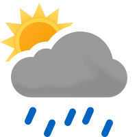
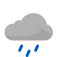
Light rain showers
18° rising to 20° 5.6 mm Wind up to 7.8 m/s Beaufort force (4)
Monday 2 Nov
Mostly clear
17° rising to 20° 16.5 mm Wind up to 17.1 m/s Beaufort force (7)
Tuesday 3 Nov
Clear skies
19° to 20° Rain intervals Wind up to 15.4 m/s Beaufort force (7)
Wednesday 4 Nov
Mostly clear
19° rising to 20° Rain intervals Wind up to 6.3 m/s Beaufort force (4)
Thursday 5 Nov
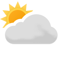
Cloudy
19° rising to 21° Rain intervals Wind up to 5.9 m/s Beaufort force (4)
Friday 6 Nov
Mostly clear
19° rising to 21° Rain intervals Wind up to 6.8 m/s Beaufort force (4)
Today31 17° rising to 20°
Saturday 31 October
Night
—
It's happened
Morning
17° rising to 19° Wind up to 4.6 m/s Beaufort force (3)
Afternoon
20° falling to 18° Wind up to 5.1 m/s Beaufort force (3)
Evening
18° rising to 19° Wind up to 2.7 m/s Beaufort force (2)
Remaining hours • 15 forecast samples • 09:00–23:00 • ranges at sample times
Rain intervals
Sat 11:00–Sat 12:00 0.2 mm / 1h Sat 12:00–Sat 13:00 0.2 mm / 1h Upcoming hours
Sunrise 06:22 • sunset 17:09
Sun1 18° rising to 20°
Sunday 1 November
Night
19° falling to 18° Wind up to 5.0 m/s Beaufort force (3)
Morning
18° rising to 20° Wind up to 6.2 m/s Beaufort force (4)
Afternoon
19° rising to 20° Wind up to 7.8 m/s Beaufort force (4)
Evening
20° falling to 19° Wind up to 7.6 m/s Beaufort force (4)
24 forecast samples • 00:00–23:00 • ranges at sample times
Rain intervals
Sun 01:00–Sun 02:00 0.3 mm / 1h Sun 02:00–Sun 03:00 0.4 mm / 1h Sun 03:00–Sun 04:00 0.6 mm / 1h Sun 04:00–Sun 05:00 0.2 mm / 1h Sun 06:00–Sun 07:00 0.4 mm / 1h Sun 07:00–Sun 08:00 0.3 mm / 1h Sun 09:00–Sun 10:00 0.1 mm / 1h Sun 10:00–Sun 11:00 0.2 mm / 1h Sun 11:00–Sun 12:00 0.8 mm / 1h Sun 12:00–Sun 13:00 0.2 mm / 1h Sun 13:00–Sun 14:00 0.2 mm / 1h Sun 14:00–Sun 15:00 0.1 mm / 1h Sun 15:00–Sun 16:00 0.2 mm / 1h Sun 16:00–Sun 17:00 0.3 mm / 1h Sun 17:00–Sun 18:00 0.4 mm / 1h Sun 18:00–Sun 19:00 0.2 mm / 1h Sun 19:00–Sun 20:00 0.6 mm / 1h Sun 20:00–Sun 21:00 0.1 mm / 1h Upcoming hours
Sunrise 06:23 • sunset 17:08
Mon2 17° rising to 20°
Monday 2 November
Night
19° falling to 17° Wind up to 10.8 m/s Beaufort force (6)
Morning
17° rising to 19° Wind up to 12.2 m/s Beaufort force (6)
Afternoon
19°
Wind up to 16.4 m/s Beaufort force (7)
Evening
19° rising to 20° Wind up to 17.1 m/s Beaufort force (7)
24 forecast samples • 00:00–23:00 • ranges at sample times
Rain intervals
Mon 00:00–Mon 01:00 0.2 mm / 1h Mon 01:00–Mon 02:00 0.9 mm / 1h Mon 02:00–Mon 03:00 1.2 mm / 1h Mon 03:00–Mon 04:00 0.3 mm / 1h Mon 04:00–Mon 05:00 1.0 mm / 1h Mon 05:00–Mon 06:00 3.4 mm / 1h Mon 06:00–Mon 07:00 2.5 mm / 1h Mon 07:00–Mon 08:00 3.1 mm / 1h Mon 08:00–Mon 09:00 2.0 mm / 1h Mon 09:00–Mon 10:00 0.3 mm / 1h Mon 16:00–Mon 17:00 0.2 mm / 1h Mon 17:00–Mon 18:00 0.3 mm / 1h Mon 18:00–Mon 19:00 0.3 mm / 1h Mon 19:00–Mon 20:00 0.3 mm / 1h Mon 20:00–Mon 21:00 0.1 mm / 1h Mon 22:00–Mon 23:00 0.2 mm / 1h Mon 23:00–Tue 00:00 0.2 mm / 1h Upcoming hours
Sunrise 06:23 • sunset 17:07
Tue3 19° to 20°
Tuesday 3 November
Night
19°
Wind up to 15.4 m/s Beaufort force (7)
Morning
19°
Wind up to 12.5 m/s Beaufort force (6)
Afternoon
20°
Wind up to 9.8 m/s Beaufort force (5)
Evening
19°
Wind up to 8.5 m/s Beaufort force (5)
5 forecast samples • 00:00–19:00 • ranges at sample times
Daily rainfall total unavailable: intervals cover 19.0 of 24.0 hours. Supplied rain intervals appear below.
Rain intervals
Tue 00:00–Tue 01:00 0.2 mm / 1h Tue 01:00–Tue 07:00 0.7 mm / 6h Tue 07:00–Tue 13:00 0.5 mm / 6h Tue 13:00–Tue 19:00 0.3 mm / 6h Tue 19:00–Wed 01:00 0.1 mm / 6h Upcoming hours
Sunrise 06:24 • sunset 17:06
Wed4 19° rising to 20°
Wednesday 4 November
Night
19°
Wind up to 6.3 m/s Beaufort force (4)
Morning
19°
Wind up to 3.9 m/s Beaufort force (3)
Afternoon
20°
Wind up to 2.5 m/s Beaufort force (2)
Evening
19°
Wind up to 1.3 m/s Beaufort force (1)
4 forecast samples • 01:00–19:00 • ranges at sample times
Daily rainfall total unavailable: intervals cover 18.0 of 24.0 hours. Supplied rain intervals appear below.
Rain intervals
Tue 19:00–Wed 01:00 0.1 mm / 6h Upcoming hours
Sunrise 06:25 • sunset 17:05
Thu5 19° rising to 21°
Thursday 5 November
Night
19°
Wind up to 2.7 m/s Beaufort force (2)
Morning
19°
Wind up to 4.0 m/s Beaufort force (3)
Afternoon
21°
Wind up to 3.7 m/s Beaufort force (3)
Evening
20°
Wind up to 5.9 m/s Beaufort force (4)
4 forecast samples • 01:00–19:00 • ranges at sample times
Daily rainfall total unavailable: intervals cover 18.0 of 24.0 hours. Supplied rain intervals appear below.
Rain intervals
Thu 19:00–Fri 01:00 0.1 mm / 6h Upcoming hours
Sunrise 06:26 • sunset 17:04
Fri6 19° rising to 21°
Friday 6 November
Night
20°
Wind up to 5.6 m/s Beaufort force (4)
Morning
19°
Wind up to 6.8 m/s Beaufort force (4)
Afternoon
21°
Wind up to 6.0 m/s Beaufort force (4)
Evening
20°
Wind up to 5.7 m/s Beaufort force (4)
4 forecast samples • 01:00–19:00 • ranges at sample times
Daily rainfall total unavailable: intervals cover 18.0 of 24.0 hours. Supplied rain intervals appear below.
Rain intervals
Thu 19:00–Fri 01:00 0.1 mm / 6h Fri 01:00–Fri 07:00 0.2 mm / 6h Fri 07:00–Fri 13:00 0.1 mm / 6h Fri 13:00–Fri 19:00 0.1 mm / 6h Fri 19:00–Sat 01:00 9.6 mm / 6h Upcoming hours
Sunrise 06:27 • sunset 17:03
A little island perspective
The islands in motion. Follow the forecast across Malta, Gozo and Comino.
Wind
Temperature
Malta, Gozo and Comino weather map
The Maltese islands, with north at the top. Select a forecast point using the controls beside the map.
GOZO COMINO MALTA N 5 km
Wind forecast Next 72 hours
A closer look
Forecast point
Loading forecast… Choose a point to see its forecast.
Loading island forecasts…
Enable JavaScript to explore the timeline. Hourly forecasts are available on the Today page .
Comino • 09:00 forecast
17° C
Mostly clear.
Last snapshot at 08:17
Wind from NE 4.6 m/s Wind • force 3
1017 hPa Pressure • sea level
About the Comino forecast
The forecast covers the Comino area in Comino. It uses the Comino model point. These are model values; conditions at a particular street or shore can differ. The issue time is shown with the forecast.
Comino hour by hour
October weather archive
On the island
Heat, rain and exposed shores Read the hourly wind as well as the temperature. Shoreline exposure changes around Comino; the island forecast is not a measurement inside the Blue Lagoon. Plan water, shade and clothing around the hours you will spend outside.
Comino weather hour by hour On the water
The crossing and the return Check regional wave height and direction for both journeys. Conditions at a landing or sheltered cove can differ from the offshore model point. A sunny forecast on land does not describe the whole crossing.
Three-day marine forecast Before you leave
Check the current arrangements Confirm departure points, return services and any visitor requirements through your operator and the official Blue Lagoon visitor service. Use current local notices and beach flags when you arrive.
Blue Lagoon visitor information
Wind directions and sheltered shores Sea temperature through the seasons Compare shoreline exposure